Experience a
3D Virtual Walkthrough
Captured on the Matterport Pro 3
7 Benefits of Virtual Walkthroughs
Convenience:
Virtual walkthroughs allow users to explore properties remotely from the comfort of their own homes. There’s no need to physically travel to the location, saving time and resources.
Accessibility:
Virtual walkthroughs make properties accessible to a wider audience, including those with mobility challenges or who are located in different geographic regions. It enables people to experience the property without any physical limitations.
Cost-Effectiveness:
Traditional in-person property visits can be costly, especially for long-distance or international buyers. Virtual walkthroughs eliminate travel expenses, making it a more affordable option for both buyers and sellers.
Time Efficiency:
Virtual walkthroughs streamline the property viewing process. Potential buyers can explore every corner of a property at their own pace, without time constraints. This efficiency benefits both buyers and sellers by narrowing down the options and reducing unnecessary visits.
Enhanced Visualization:
Virtual walkthroughs provide a realistic and immersive experience. Users can visualize the property’s layout, flow, and spatial relationships more effectively compared to static images or traditional floor plans. This helps potential buyers make informed decisions and develop a better understanding of the property.
24/7 Availability:
Virtual walkthroughs are accessible at any time, allowing users to view properties whenever it’s convenient for them. This flexibility accommodates different schedules and time zones, ensuring that no potential buyers miss the opportunity to explore a property.
Marketing Advantage:
Utilizing virtual walkthroughs as part of a property listing can give sellers a competitive edge. It showcases their property in a technologically advanced and innovative manner, attracting more attention from potential buyers.
Request a Quote today
More Popular Deliverables
Available Deliverables

Virtual Walk throughs

BIM Files

Point Cloud Data files

2D Schematics

BIM Files

360° Photography & Panoramic Images
View Popular Deliverables by Industry
Residential Real Estate
Our digital twins, created with the Matterport Pro3 camera, accelerate sales and leases by showcasing captivating 3D tours and high-quality photography to potential tenants and owners.
Commercial Real Estate
Efficiently manage buildings by gathering comprehensive data on space allocation, floor planning, and maintenance. This data can be accessed by stakeholders from anywhere, facilitating optimal building utilization and cost control.
Industrial Manufacturing
Leverage detailed visuals for teams to document safety protocols, perform remote inspections, and speed up training.
Architecture Engineering & Construction
gsrthwtjnwtnntneywyjwjwyjw
Insurance and Restoration
rghsrtndtyndnetyetynwnwyne
Experience a 3D Walk Through
Captured on the Matterport Pro 3
Quick & Affordable Field Measuring
Using state-of-the-art equipment and cutting-edge software, our experienced team of experts can create stunningly detailed 3D models of any physical environment.
From architecture, to construction sites, and event venues, we can capture the reality of your vision and turn it into a digital masterpiece that you can manipulate, analyze, and share with others.
360° Panoramic Documenting Services
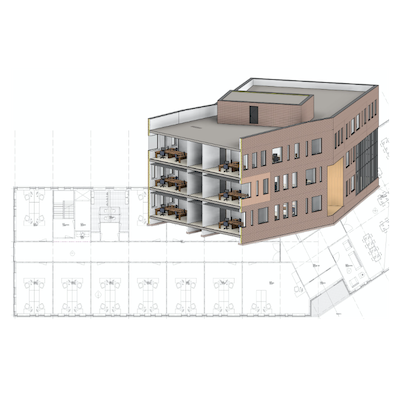
Using state-of-the-art equipment and cutting-edge software, our experienced team of experts can create stunningly detailed 3D models of any physical environment.
From architecture, to construction sites, and event venues, we can capture the reality of your vision and turn it into a digital masterpiece that you can manipulate, analyze, and share with others.
Scan Options
2D Schematic Floor Plan
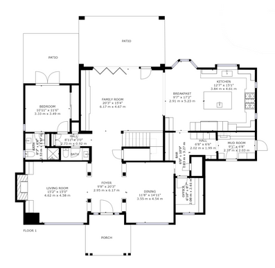
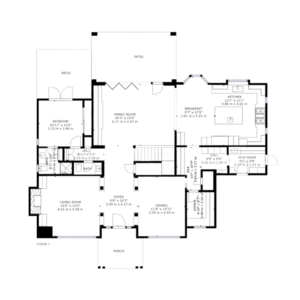
Marketing ready, black & white floor plans for your space. Our equipment leverages the spatial data captured in your Spaces to produce a 2D schematic that showcases the property.
Details: Schematic floor plans are an essential property marketing asset for attracting buyers. When you order a Matterport floor plan, the hard work is done for you so you receive a ready-to-use floor plan without having to measure the entire property by hand. All you have to do is just scan.
Floor plans are marketing ready on delivery and can be customized further. Vector files (SVG) are included which are ideal for your editing the features of the floor plan quickly while maintaining the level of detail.
Measuring Standards: Your floor plans will be measured based on the standards specified in the International Property Measurement Standards (IPMS). Residential buildings are measured according to IPMS Residential 3B Standards with the exception that the floor area of balconies and patios are stated separately to the rest of the building. Office spaces are measured according to IPMS Office standards.
If there are any local standards in your area, please check that these floor plans meet local requirements and use cases.
BIM File
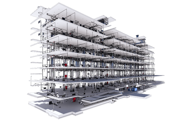
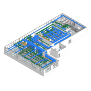
Transform your spatial data to a LOD 200 building information model (BIM) in .RVT and .DWG format.
Files Included
- RVT file (compatible with Revit 2020/2021)
- DWG file (per floor)
- IFC file (platform neutral and can can be read or edited by any BIM software)
- RCS File (ReCap point cloud)
File Options – Select Building Features
- Architecture: The building’s basic architecture, such as walls, doors, stairs and windows.
- Architecture and Furniture: Plans include generic models of all non-architectural features (i.e. tables, seating, cabinets, appliances, and some wall fixtures).
- Architecture and MEP: Plans include generic models of visible systems pertaining to mechanical, electrical, plumbing (mechanical equipment, ducts, some conduits, some pipes, some outlets).
- MEP and Interior Furniture: Plans include generic models of all non-architectural features, as well as visible systems pertaining to mechanical, electrical, and plumbing.
- Complex MEP and Industrial Spaces: Plans include generic models of all non-architectural features, as well as visible systems pertaining to mechanical, electrical, and plumbing. (For Mechanical Rooms and Spaces, Electrical Rooms and Spaces, Data Centers and Industrial Type buildings)
E57 pointcloud File
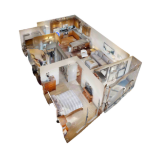
The file format .e57 file is a vendor neutral point cloud file that can be imported into most 3D design software.
The file format, .E57, is a compact, vendor-neutral point cloud format that’s defined by the ASTM E2807 standard. This format is widely adopted by most 3D design applications, so you can use your Matterport digital twin in a wide range of applications, including but not limited to:
- Autodesk Recap Pro
- Leica Register 360
- Leica Cyclone
- Faro Scene
- Autodesk Revit
- Autodesk Navisworks
- Autodesk
- AutoCAD
- Trimble Sketchup
- Trimble Business Center
- TopCon Magnet
- Cintoo Cloud
Request a Quote today
2D Schematics
Forget about carrying around your measuring tape! Instead, opt for floor plans that utilize the spatial data extracted from your Spaces.
